Kanu ![]() Links
Links
The LaVase Portages
The woods and bogs of the Ontario town of North Bay hide one of
Canada's most significant travel links
(click on the image for more pictures of the route)
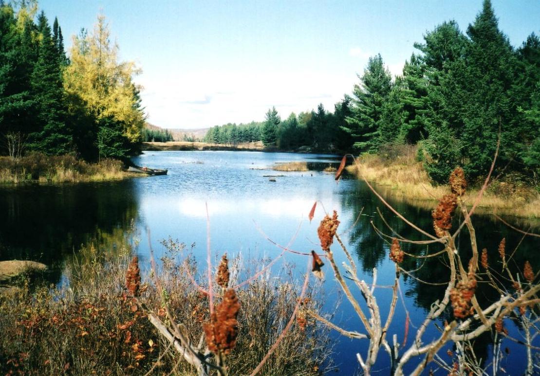
Canada's fur trade routes are well known and documented. Anyone interested can follow them by paddle and portage, with one notable exception: the LaVase portage. The literature and public brochures give you a general outline, but they lack the detail to allow you to retrace it on your own. There are cairns at highway 17 and at the lakeshore, but don't rely on the posted map at Dugas Bay to guide you successfully across as it is not accurate enough. Let me fill in this gap...
| You should expect that a few things have changed since the days of
the voyageurs. For one, sections of the portages are routed away from their
original location, because some land has been taken over by industries (e.g. the quarry
and the safety perimeter around a chemical factory). In other places, the water level has
changed and drowned the original path. And, there is a section of the LaVase River
that the voyageurs had to portage since they could not maneuver the large boats around the
tight bends of the river - while you can paddle and enjoy the swifts and riffles. Last not
least, urbanization has brought railways, roads and houses to the southern end of the
route. But, the upper sections of the route are still in a natural state,
and if you are willing to put up with the chore of portaging, you can retrace the steps of
Canada's explorers on this crucial link of the Canadian fur trade routes. There has been little use of the portages over the last decades, maybe because they are a bit of a chore, because urbanization encroached in the lower sections and, with people having cars to go further, paddlers went elsewhere for their weekend trips. As a result, today's LaVase portages need an experienced guide to take you across. |
What others have said: A few people have crossed
the continent in recent years by boat, and some have documented the difficulty of the
LaVase portages. In "Coke Stop in Emo", Alec Ross describes how he carries
his boat through the city's streets, competing with the traffic. The McGuffins
("Where Rivers Run") were wise and made North Bay the seam between two sections
of the trip: in 1983 they finished their trip on the shore of Trout Lake, and the
following year, they continued from the shore of Lake Nipissing, thus avoiding LaVase
altogether. This was a wise decision, when you consider how, Ilya Klvana describes the
route in his journal, on
September 16, 1999: |
If it was not for dedicated individuals and specifically the North Bay-Mattawa Conservation
Authority, we might not have access to the portages any longer. Occasionally, sections
of the trail were cleared and marked with flagging tape. A parking lot was created at the
north end specifically for the portages. Where the trail goes over privately owned land,
agreements with (most of) the landowners have been worked out and in any case, the Ontario Public Lands Act protects
your right to move yourself and your gear across portages. 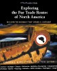
And, if you are curious about the fur trade and its routes in general, an excellent
book has been published recently: "Exploring the Fur Trade Routes of North
America", by Barbara Huck. It not only details the routes and portages but
also gives valuable insights into the trade. The illustrations are true and plenty, thus
making it a pleasure to peruse. Click on the image on the left to display the publisher's
webpage.
![]()
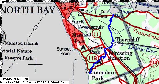
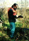 On
a day in late fall of 2001, Paul Chivers took me across the portages. I
recorded the exact trail with a GPS and overlaid the GPS track file onto the topo maps.
Above is the overview map in scale 1:250,000, showing the route from Dugas Bay in Trout
Lake heading south to Champlain Park on the shore of Lake Nippissing. More details are
below. Allow for a good part of the day for the trip - we did it in about 6 hours, and we
had high water levels that made paddling easy. It will be difficult to follow the
trail in the bush in some of the dense areas since any flagging seems to get removed by
"whoever" and the track overgrows quickly. So, give yourself extra time...
On
a day in late fall of 2001, Paul Chivers took me across the portages. I
recorded the exact trail with a GPS and overlaid the GPS track file onto the topo maps.
Above is the overview map in scale 1:250,000, showing the route from Dugas Bay in Trout
Lake heading south to Champlain Park on the shore of Lake Nippissing. More details are
below. Allow for a good part of the day for the trip - we did it in about 6 hours, and we
had high water levels that made paddling easy. It will be difficult to follow the
trail in the bush in some of the dense areas since any flagging seems to get removed by
"whoever" and the track overgrows quickly. So, give yourself extra time...
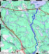 Left: Upper Section: Dugas Bay to La
Vase River (click on map for details)
Left: Upper Section: Dugas Bay to La
Vase River (click on map for details)
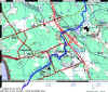
Right: Middle and lower section: LaVase River (click on map for details)
| Geological and archeological information: Even though the LaVase portage was the key link of the Montreal-based fur trade routes, much of the earlier traffic across the height of land used a different route - via Park Creek, a bit further to the north. It allowed an easier portage for the smaller canoes used by native travellers but was unsuited for the large and heavy Canot du Maitre. A website set up by the city of North Bay has excellent information on the archeological digs in the area and the underlying geology of the area. Click here! |
| Native Names for Historic Portages (I
believe the information came from Craig Macdonald): Kotchewanicamingue
- Northern portage (place where you put on the load???) |
When you do this route, a GPS will be of great help. You can download a tracklog
and a waypoint file from this website and upload it from your computer into your GPS, then
navigate with the help of that neat technology. The files are text files, in PCX5 format,
which can be imported into utilities like GPS Utility, OziExplorer, and QuoVadis
Touratech.
| Track File | Waypoint File |
Credits: My thanks to Paul Chivers for taking me through the routeand and sharing his knowledge. Also, I owe to Larry for loaning me his GPS so I could record the trip.
Note about the map images:
Copyright: Extract of the data sets | |
| The maps were produced with QV Touratech using the topomaps from QuoVadis. |