Kanu Links
Side Creeks to the
Spanish River
All photos will expand when you click on them
![]()
Mogo River:
| June 1999: "We have made camp at the top of the rough portage, and are lazing in the heat of the early evening. It is an idyllic spot: the valley is squeezed between rough hills, and the river is deep and still before its drop. The muted roar of the waterfall below underscores the serenity of the pines and cedars that grow out of Precambrian rock. Suddenly, something moves on the opposite shore: a chocolate brown animal, more than twice the size of a mink, is single-mindedly travelling across the rocks and logs, heading for the row of stones that allow a dry crossing of the river to our side. It's gone in an instant - and then there is a rustle in the cedar beside the campsite: a brown head with big eyes and rounded teddy-bear ears peers intently at us two campers. Thirty seconds later, the head is gone and we see the fisher, this large member of the weasel family, move back across the river to disappear in the trees behind. We've been reconnoitered and judged harmless...." |
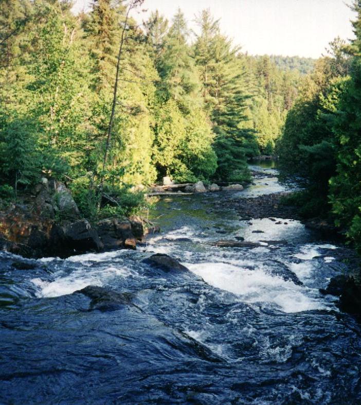 The Mogo connects Kennedy Lake
with the Spanish River and is quite suitable for paddling.
The Mogo connects Kennedy Lake
with the Spanish River and is quite suitable for paddling.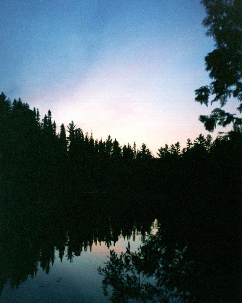 The portages are rough and not
for the faint of heart, but in between there level water that allows paddling with little
need to drag over shallows, even at low water. In the 1970's, gold was found in this
valley, and a prospector's stake can still be seen (1998) at the liftover beside the
little fall. See the Spanish River Side Trip description for
portage details.
The portages are rough and not
for the faint of heart, but in between there level water that allows paddling with little
need to drag over shallows, even at low water. In the 1970's, gold was found in this
valley, and a prospector's stake can still be seen (1998) at the liftover beside the
little fall. See the Spanish River Side Trip description for
portage details.
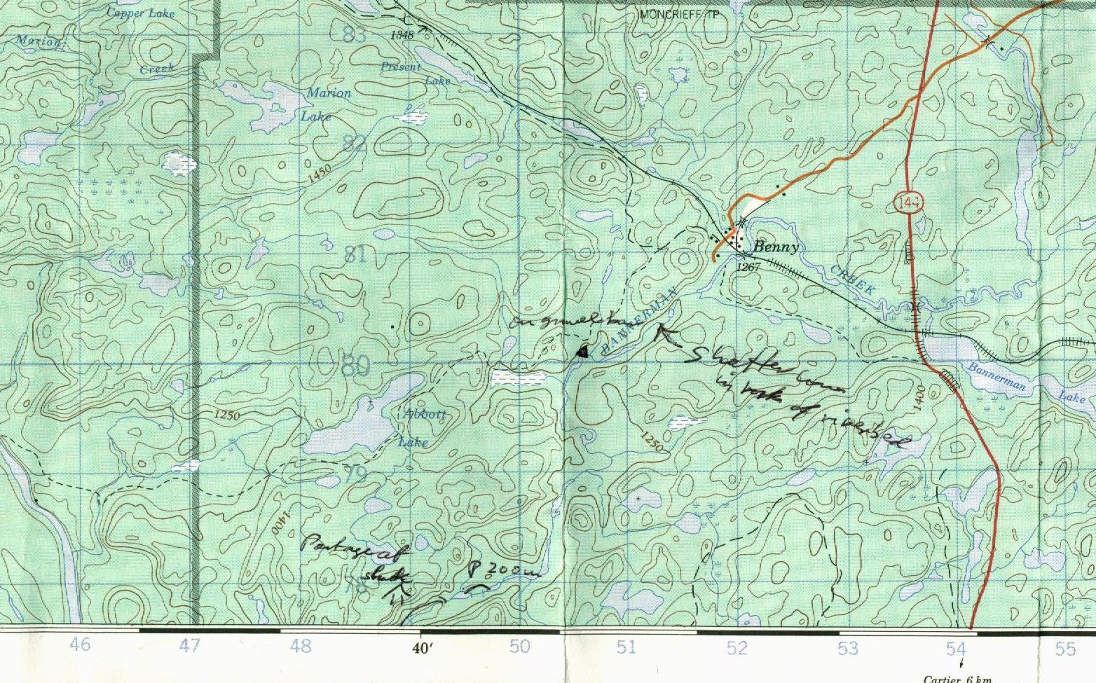
![]() Map of the portages on the Mogo River
Map of the portages on the Mogo River
© Her Majesty the Queen in Right of Canada, reproduced with permission from
Natural Resources Canada
![]()
Bannerman Creek:
|
.jpg)
Bannerman Creek drains  Onaping
Lake and the water level is dependent on the state of the dam there. Our trip started at
Benny, a forgotten railway community where the CP Rail line crosses the creek and we
continued down to the Spanish. The return was done by paddling that river to the Elbow,
and getting a lift back from the Elbow by the folks from Fox Lake Lodge.
Onaping
Lake and the water level is dependent on the state of the dam there. Our trip started at
Benny, a forgotten railway community where the CP Rail line crosses the creek and we
continued down to the Spanish. The return was done by paddling that river to the Elbow,
and getting a lift back from the Elbow by the folks from Fox Lake Lodge.
 When
we paddled "the Creek", the water was extremely low, and we had to drag the
Oldtown Penobscot canoe over long stretches of pebbles and boulders. These same areas
would
When
we paddled "the Creek", the water was extremely low, and we had to drag the
Oldtown Penobscot canoe over long stretches of pebbles and boulders. These same areas
would 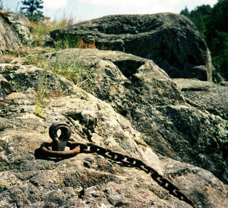 make
for some exciting class II and III runs at higher water, and the locals confirm this as a
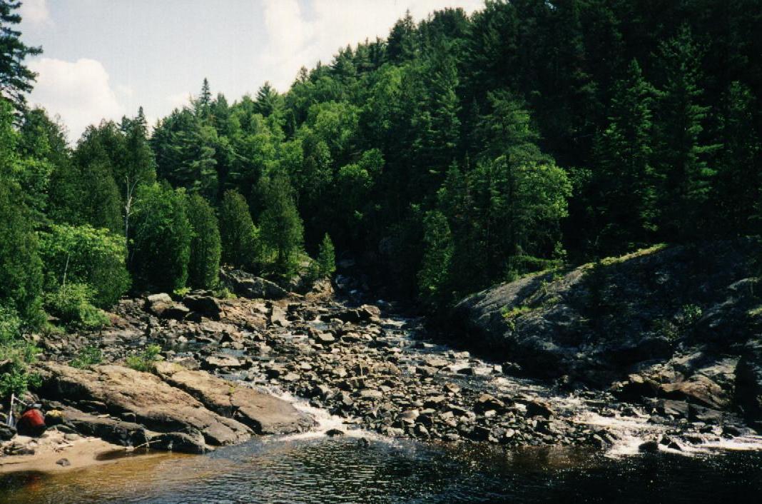
fine place for spring canoeing. There are two major water falls on this river that
necessitate two portages of around 200m and 300m, both on the right side of the river.
Camping is mostly on the many gravel bars of this river. The map calls it Bannerman Creek,
and the green sign put up by the highway crews tells us it is Moncrieff Creek (after the
township's name), but a chap whose backyard we used to launch the boat said the folks in
Benny just call it "The Creek"
make
for some exciting class II and III runs at higher water, and the locals confirm this as a
fine place for spring canoeing. There are two major water falls on this river that
necessitate two portages of around 200m and 300m, both on the right side of the river.
Camping is mostly on the many gravel bars of this river. The map calls it Bannerman Creek,
and the green sign put up by the highway crews tells us it is Moncrieff Creek (after the
township's name), but a chap whose backyard we used to launch the boat said the folks in
Benny just call it "The Creek"
. Map of Bannerman Creek, from Benny towards the Spanish, which
appears at the left margin of the map.
Map of Bannerman Creek, from Benny towards the Spanish, which
appears at the left margin of the map.
© Her Majesty the Queen in Right of Canada, reproduced with permission from
Natural Resources Canada
![]()
Agnes Creek or River:
| June 1999: "OK, I've screwed up. I can still step on the ankle but we dread having to handle the next portage and Ed may have to take both gear and canoe all by himself. The previous day, we were wading upstream, stumbling over the slippery rocks in the Agnes Creek and I had lost balance to come down hard on a sharp rock, making me wince with pain. It didn't feel so bad right immediately after that mishap, as we kept on sloshing and slipping over the bouldery bottom to drag the canoe - the cool water and the task at hand had had a anesthetic effect. Later, I even had walked several kilometres on the 4-wheeler track with this foot when we gave up on paddling or poling the river to proceed on land and get a feel for the state of the river further upstream. But now, the ankle is thick and hurts - it does not like portages..." |
This river enters the Spanish just below the Graveyard Rapids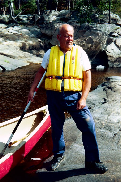 across
a pebbly delta and with a good volume of water and crystal clear water. It's easy to
believe there might be good canoeing upstream. We tried, but gave up after proceeding
upstream for about 2 km and guessing that the next kilometre or more would not have much
else to offer. The river drops in a constant shallow gradient and, at mid-summer, the
water is not high enough to keep the canoe floating over the bouldery riverbed. In spring
conditions, this is a fast class II river, I hear.
across
a pebbly delta and with a good volume of water and crystal clear water. It's easy to
believe there might be good canoeing upstream. We tried, but gave up after proceeding
upstream for about 2 km and guessing that the next kilometre or more would not have much
else to offer. The river drops in a constant shallow gradient and, at mid-summer, the
water is not high enough to keep the canoe floating over the bouldery riverbed. In spring
conditions, this is a fast class II river, I hear.
![]()
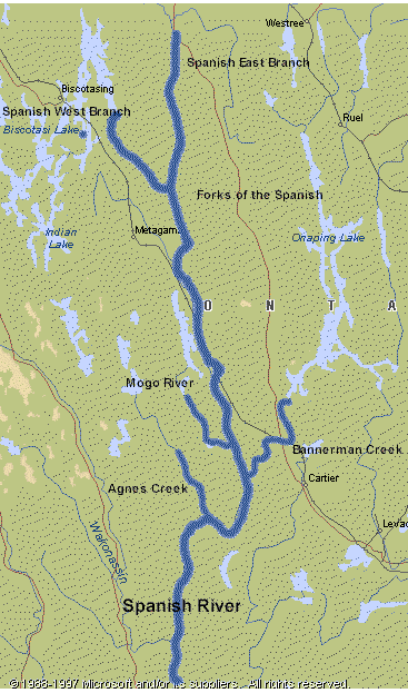 Overview Map.
Please excuse the awkward location of this map. I would have preferred to place it at the top of this webpage, but the web browsers (Netscape as well as MS Explorer) cannot handle it and produce a garbled page.
Picture Credit: the photos of Mogo and Bannerman Creek were
taken by Doug Miller
![]()
Click here to get back to Erhard's Home Page
Click here to get to Erhard's Favorite Paddling Areas
Disclaimer
The advice provided on this webpage has been compiled based upon 30 years experience canoeing in Ontario. Every effort has been made to ensure that the advice in this web site is correct. Even so, I do not accept any responsibility for errors or misrepresentations contained herein.
WARNING! This advice is intended for use by those with some prior experience in camping, canoe-tripping and backpacking. I do not assume responsibility for the safety of individuals, nor do I accept liability for any loss or damages that might arise in the course of following the advice presented in this web site.