Update June 14, 2003:
More on the access from the south end: during summer 2003, the MNR had managed to
convince the snowmobile club to add more rboulders and thus effect the blocking of the
access. This year, I dropped by in early May, and the road was open. Well, they are a bit
slow, I figured. But already some vehicles had driven down the snowmobile
"trail"... When I
returned again in late May, the same picture presented itself, and I decided to stop by at
the MNR office in Parry Sound. They took quick action, and here's the letter that came
recently (dated June 6):
Dear Mr. Krause,
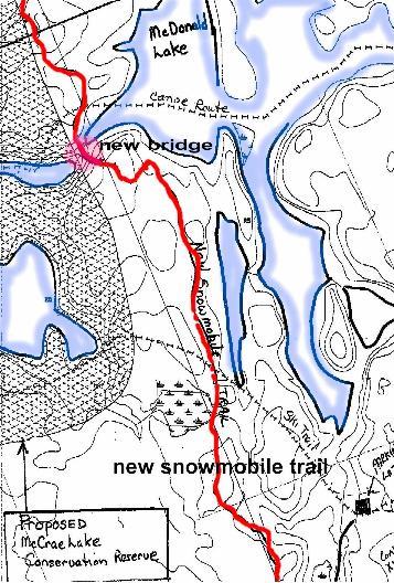
Subject: Entrance to McCrae Lake Snowmobile Trail - Part of TOPS Trail "C"
Part of Lot 25, Concession XV, Geographic Township of Baxter,
being in the Township of Georgian Bay, District Municipality of Muskoka
This is further to your discussions with Ministry staff (Heidman & Shaver) at this
office on May
27, 2003 respecting the above noted snowmobile trail. As a result of information you
provided,
MNR staff conducted an inspection of the trail on May 28, 2003. During the course of the
inspection it was discovered the snowmobile club has failed to barricade the entrance of
the trail
on Crooked Bay Road as was verbally agreed to in 2001.
We have advised the snowmobile club this barricade is an important component of land
management in the McCrae Lake area and helps prevent other motorized vehicles (i.e.ATVs)
from using this trail during the non-winter months. Furthermore, it is the responsibility
of the club
to ensure this barricade is maintained from April 1st to November 31st annually, and as
such we
asked them to immediately ensure the barricade is adequately placed to make sureATVs are
unable to access the trail. MNR staff will monitor this situation to ensure the work is
done to our
satisfaction.
In the 2003/04 season, the club's Land Use Permit for this trail will be amended
to include the
condition that the entrance of this trail must be barricaded from April 1 to November 31st
annually to restrict all motorized vehicles. Failure to comply with this condition may
result in this
Ministry refusing to issue the club subsequent Land Use Permits for this trail.[highlighted
by EK]
Thank you for your interest and information in this matter. If you have any questions or
wish to
discuss this matter further please contact Laura Knight Heidman, Resource Management
Technician at (705) 773-4243.
Thank you,
Andy Heerschap
Area Supervisor, Parry Sound
Parry Sound District
So, paddling folks, don't be shy to speak up: there are
people that will listen!
Update December 28, 2001: 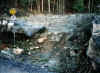
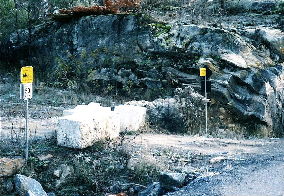
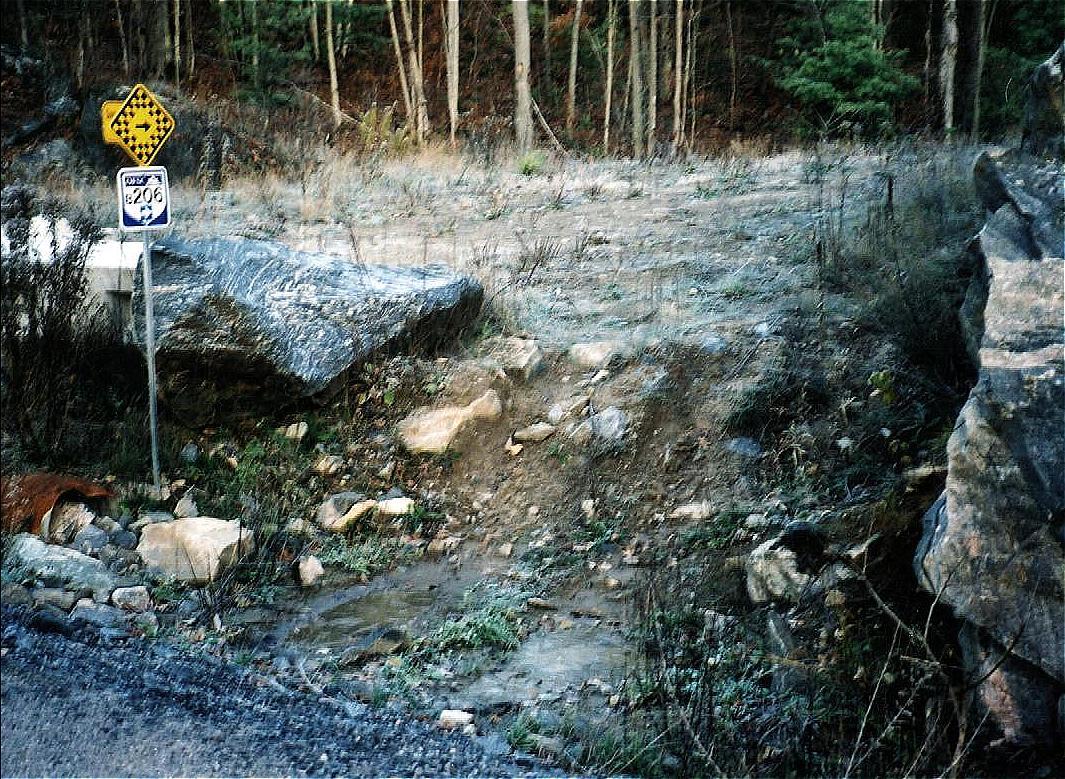
The inability of the MNR to control access by ATVs from the south
is obvious in the two pictures here. On the left, the row of concrete blocks won't let any
ATVs through, right? Well, take a look at the picture on the right: the ATVs just drive
around them. If it is so difficult for the MNR to ensure that ATVs stay away, why did they
approve the road in the first place? (the pictures were taken in early November)
Update November 23, 2001
A Complaint to the Department of Fisheries and Oceans, Ottawa
(who are supposed to enforce their own rules on blasting near water):
From: Greg Brasseur (click
on his name for his McCrae Lake website and a good set of pictures of McCrae and its
beauty)
The Honourable Herb Dhaliwal
House of Commons
Minister, Fisheries and Oceans Canada
Parliament Buildings, Wellington Street
Ottawa, Ontario, K1A 0A6
Canada
Dear Sir:
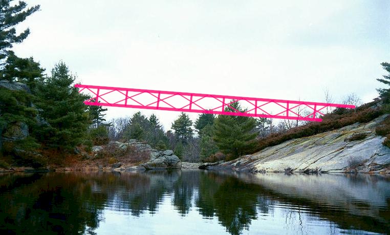
I wrote to you on June 26, 2001 about the construction of a bridge over the
McCrae Lake rapids. This waterway is accessible by canoe via the McDonald
River west of highway 69 north of Honey Harbour adjacent Georgian Bay in
Ontario. The complaint dealt with the unauthorized use of explosives in the
construction of the bridge. A substantial amount of rock was blasted away
from the river bank into the water.
After several months of waiting for a reply and only after a subsequent
letter, you wrote me an evasive answer. You told me that no authorization
was required to use explosives and no offense occurred because no fish were
killed. It is clearly stated that authorization to use explosives is
required under the Fisheries Act in the Fishery (General) Regulation
(SOR/93-53) on page 38. This is page 4 of the application for authorization
to build a structure affecting fish habit. It is attached to this message.
The Ministry of Oceans and Fisheries collaborated with the Ontario
Ministry of Natural Resources to build a snowmobile road on provincial
crown land for a private snowmobile club. The MNR issued the permit for the
road. The permit for the bridge had to be issued by the Department of
Fisheries. Your department and the MNR are responsible for ruining one of
the most beautiful and scenic canoe portages in the world.
Your department made several errors in approving the bridge construction.
Common sense tells you that you don't put a bridge across a canoe portage
in the first place. The bridge not only creates problems for canoeists but
places their lives in danger.
The choice of a steel beam bridge was wrong for the area because it
attracts lightning. Thousands of people use this portage every summer. The
canoe portage is in an isolate area and takes considerable time to
traverse. The bridge provides the only shelter in a storm. The area is
known for sudden violent electrical storms which sweep across Georgian Bay.
The placement of a steel beam bridge there places people at risk of being
struck by lightning.
Your department made a wrong judgement about the clearance of the bridge.
It is set too low. People are dropping their canoes on the ground trying to
getting around it. It is an obstruction.
The bridge was constructed despite overwhelming objections by the public
months before it was actually built. The road could have been diverted
elsewhere and the bridge built over another high elevation. The public
didn't want this bridge put there in the first place and they don't want it
there now.
Once again, I am writing to ask you to investigate the unauthorized
dynamiting of the river. Someone should be sent to the area to inspect the
damage. All laws should be enforced. If you do not agree that this should be
done, please explain to all the people below why it is not a problem with
you if private clubs and individuals dynamite Canada's waterways.
Update July 28, 2001
A new Hazard at the Portage:
From: Greg Brasseur
"I just got back from McCrae Lake yesterday. I decided to take a break when
I portaged my canoe by leaning against the wooden form filled with rock
shards, which supports the bridge. I was leaning against the east side of
the form when something happened. I heard this strange hissing sound. It
almost sounded like someone gargling. It was a very low pitched sound but
it became increasingly louder. I wondered if the sound was coming from the
rapids. Eventually, I realized it was a rattlesnake. I looked around my
feet but I couldn't see anything. Then it dawned on me that the snake was
in the wooden form behind me. When I stepped away from the form the sound
stopped. I couldn't see the snake. It was either in between the rocks or on
top of them.
I saw another snake on the rapids portage earlier in the week when I first
arrived. This was closer to the beginning of the rapids. I was carrying the
last of my stuff up the hill when I saw it laying across the trail. It was
as thick as my forearm. It was covered with big dark spots and was either
light yellow or brown. I couldn't see the tail so I am not sure if it was a
rattler.
Note (Erhard speaking now): Alas, it's a serious
practical problem: a structure that houses
rattlers right at the portage. The snakes will want to sun during the day and
go hunting for mice etc. once the sun goes down. There are hundreds of
paddlers that pass by each summer weekend and it's not a question "if
there's an accident" but "when". A sign would be useful, with
something like:
 | watch out for them schnakes! |
| leave them in peace and, by the way, they are rare and protected |
| in case of bite, it's not fatal. Just keep the victim calm and at rest,
leave
the bitten limb below heart level and
bring the victim to the nearest hospital(Parry Sound) |
Actually, in my opinion, the MNR allowed that the rock piles were created and
thus they have an obligation to do something, like putting up the sign. Or else
take down the damn rock pile.....
Update July 24, 2001
Snowmobilers are reminded to own up to their responsibilities:
From: Ben Martin
(Ben had written to the MNR:
>Dear Sirs:
>
> I am deeply disturbed by and concerned with the outcome of the Baxter bridge
> and road. It has come to my attention that, among other developments, the
> construction impedes access over the portage trail to McRae Lake. This is
> more than just a minor recreational inconvenience. I am a member of Five
> Winds Ski Touring Club, which, as you may know, develops, maps and maintains
> a series of trails in the area for its own (and public) use. One of the
> trails circumscribes McRae Lake. For more than 10 years I have maintained
> the section of the trail at the far end of the lake. In so doing I must
> canoe accross the lake, using the portage which has now been rendered
> precarious.
>
> Furthermore, it appears that the bridge and road may not comply with
> approved permit/plans and the issues that concerned me, viz. atv/snowmobile
> abuse and destruction of habitat has occured. What was once a proximate (to
> Toronto where I live) area of natural beauty and sanctuary has been scarred
> and worse, rendered hazardous. As a lawyer practising law for more than 25
> years, I might add that you may also have some liability concerns. I
> respectfully request that you review the forgoing developments and take any
> necessary remedial action. Your reply would be appreciated.
The MNR replied:
>
> Thank you for your e-mail of July 20, 2001 regarding a snowmobile trail near
> McCrae Lake.
>
> Ministry staff in Parry Sound District reviewed and approved the trail
> project after extensive consultation with 14 government agencies and all
> interest groups that were known to them at the time. The review focused on
> minimizing environmental impact while providing a practical route through
> difficult topography as far away as possible from McCrae Lake. The ministry
> granted approval for the trail in February 1999.
>
> Approval of the snowmobile trail included a number of conditions designed to
> minimize impacts, including conditions to prevent the use of the trail as a
> road. These conditions include:
>
> * placement of barricades at each end of the bridge on the river from
> March 31st to December 1st annually to restrict all traffic except
> pedestrians from crossing the bridge;
> * working with the Twp. of Georgian Bay to construct of a permanent
> ditch at the southern end of the trail at Georgian Bay Road to restrict
> motorized vehicles other than snowmobiles; and
> * a water crossing (culvert) will not be installed north on the trail
> to stop motorized vehicles other than snowmobiles from travelling south.
>
> An inspection of the trail and bridge was conducted by MNR staff on June 27,
> 2001. As a result, the Baxter Snow Riders club was contacted and instructed
> to take further action to block the trail and also investigate solutions to
> the portage problems. MNR will continue to deal with the club in order to
> try to alleviate these concerns.
>
> If you have additional questions or concerns, please contact Mr. Andy
> Heerschap, Area Supervisor at the Parry Sound district office. Mr. Heerschap
> can be reached at (705) 773-4236 or by mail at Ministry of Natural
> Resources, 7 Bay Street, Parry Sound, Ontario P2A 1S4.
>
> Thank you for writing. I trust this information is of assistance to you.
>
> Sincerely,
>
> Bob Griffiths
> District Manager
> Parry Sound District
>
> P: (705) 773-4204
> F: (705) 746-8828
>
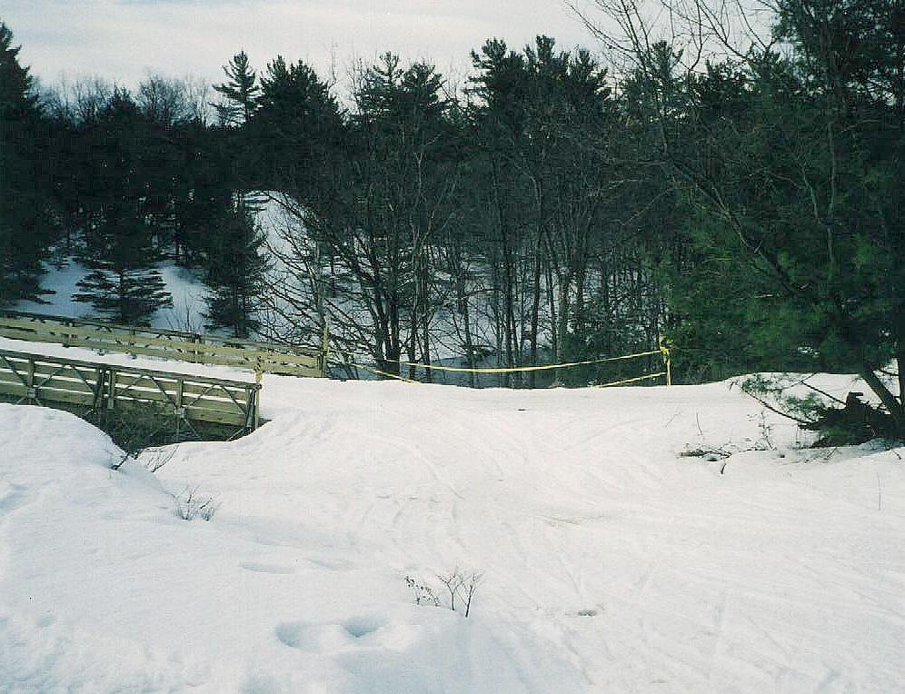
Update March 20, 2001:
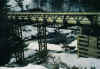
From: Erhard
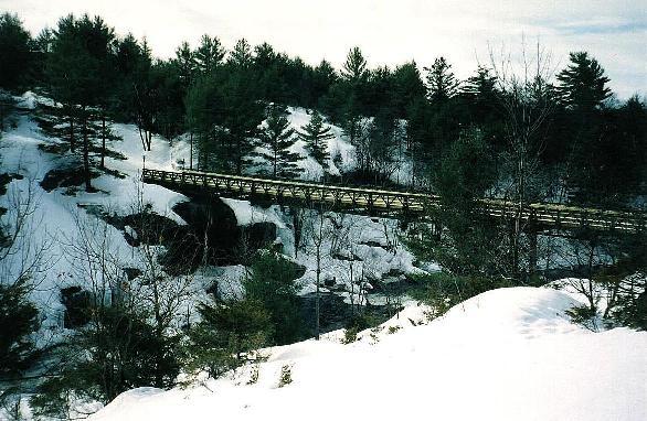
On a sunny March morning, I skied in from the south, from Georgian Bay Road. The
forest if beautiful under its three foot cover of snow. But the snowmobile road is here
and it has been busy. After all, it is complete. There are signs are all along (e.g.
"speed limit 50km/hr"), the bridge is up,and it looks very pretty for a
snowmobiler who can now look at the waterfall. But did we paddlers ever get shafted:
| the bridge is the eyesore, just as we anticipated. |
| the portage is obstructed, contrary to the planning spec's. You now will have
to swing your canoe away from the old trail and amble around a bridge pillar, then take
one big step down a rock step to regain the old path. I am not sure how tough it will be.
Once the snow is gone, we'll know |
| There was supposed to be big rocks where the "monster trail" meets
Georgian Bay Road, and the bridge is supposed to have gates. But no such thing, and ATVs
will assert their presence in another ten days when they are allowed to travel here. |
| They brought in some ugly concrete blocks to create a barrier between road
and river. I am trying to figure out how this fits in a Conservation Reserve - it just
doesn't! |
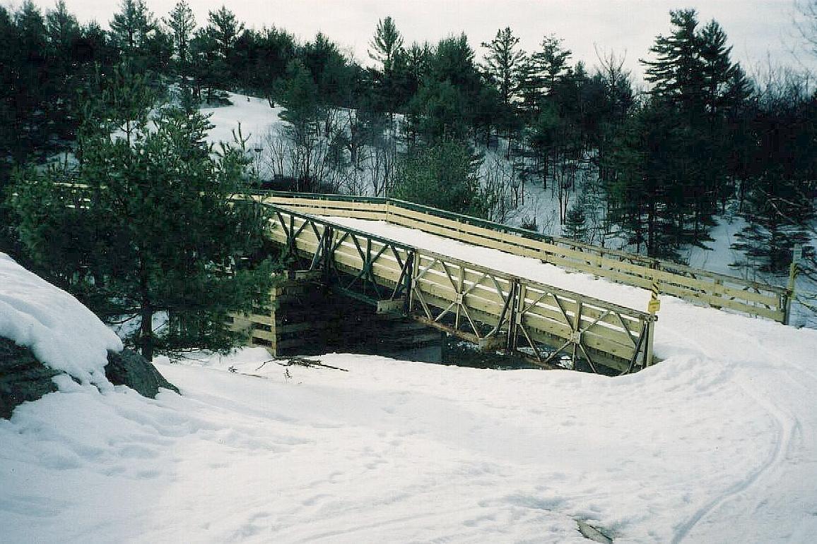
The picture above showed you the bridge from the crest of the portage hill.
Mercifully, some trees and bushes hide the bridge supports. As you proceed along the
portage, you'll see more:
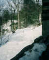
|
This is where the portage meets the new road. The old trail can no
longer be used, and the builders used yellow tape to tell you not to walk there |
|
So, you turn left and walk immediately to the left of this ramp in
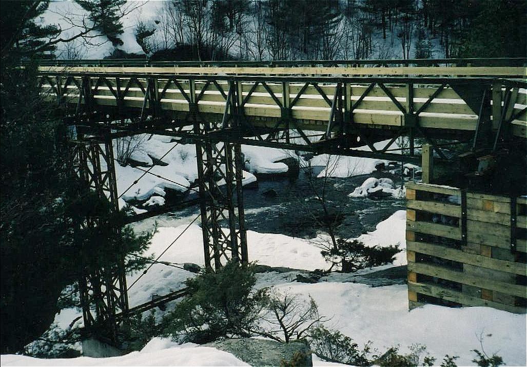
order to go underneath the bridge, past the newly created cribbing. |
|
Here, just past the cribbing and before the steel pillars, you turn
right, underneath the bridge. |
|
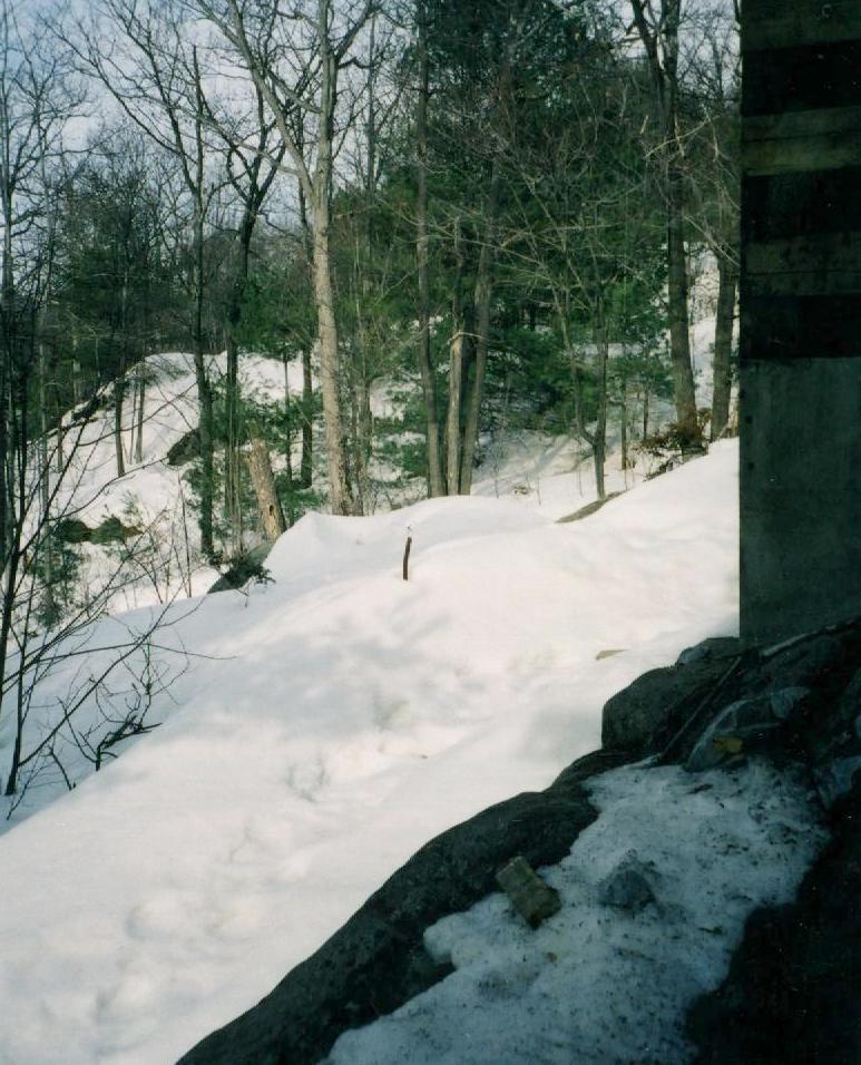
As you get out from underneath, you come to a high ledge that you
have to step down, about three or four feet. With a load on your shoulders, this is a
major obstacle, especially if you are not physically fit. Now, picture this at the busy
weekends, with parties making several trips, a true traffic jam. |
|
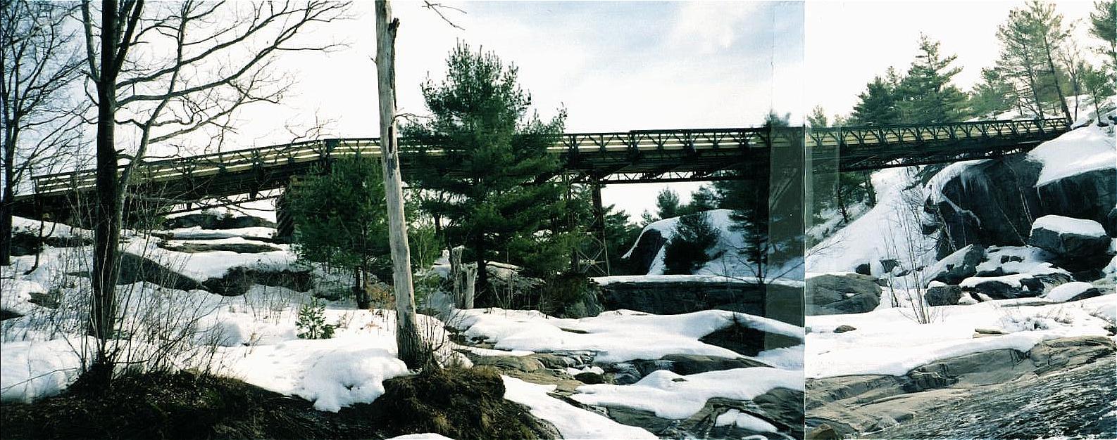
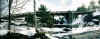
The view from the other side, the image of the falls at the end of
your wilderness adventure, after having explored Georgian Bay, paddled the Gibson Loop or
just spent a weekend at McCrae Lake. This is the view that will stay with
us for the future. Gloat, if you had a hand in promoting the road. Hide in shame if you
were supposed to be a steward of the land but approved the construction instead.
And cry, if you love nature.... |
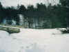
Update November 27, 2000:
From: Paul Leadbitter, FON
It looked like the were building the "cradles" on either side. The
bridge itself was still sitting in piles like it
was in the summer. That was a week and a half ago. I would think it would be
wet and dangerous to keep
building in the weather they have had up there. I have to go to Parry Sound in early
December and I will try
and take a look.
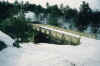
Update October 23, 2000:
From: Paul McCormick (posted on the Canadian Canoe Routes Forum)
Date: 10/23/00
Time: 9:04:16 AM
Remote Name: 208.50.80.69
Spent this past wonderful warm weekend in Mcrae lake. The cement foundations for the
bridge are poured and in place now. The bridge its self will probably be up in the next
couple of weeks. There were a a bunch of ATV's parked on the south side, with people
standing around and gocking at the site (but no actual work going on that I could see)
There was also a lot of workers garbage scattered around, (bottles, lunch bags etc). So
much for the idea that the trail would be limited to snowmobiles in the winter. You had
better get used to the drone of ATV's racing up and down that trail at all hours and the
garbage at the falls that will surely come with the access trail now.
Update July 10, 2000:
It's three months later, and my thanks to the many folks that took the time to
register their protest with the MNR. This made possible some changes of significance. Last
month, the following organizations met with the MNR and the snowmobile clubs: the
Federation of Ontario Naturalists (FON), the Friends of McCrae, Five Winds Ski Club, the
Wilderness Canoe Association, and the Barrie Canoe Club. The bridge and road are here to
stay, but the following agreements will attempt to reduce the destructive impact of the
road and make a recurrence of such travesty more difficult:
| Concerning summer use: The MNR will ensure that the road is effectively
blocked from the south to vehicles. The bridge itself will be blocked for al but
pedestrian traffic. The road to the bridge will be accessible by ATV from the north from a
quarry parking lot beside Hwy 400. |
| The FON and the Friends of McCrae will monitor the impact of the road during
summer. |
| The FON, the Friends of McCrae, the Barrie Canoe Club, and the WCA have been
added to the notification list for areas near McCrae Lake. Also, the MNR will determine a
way to notify the FON of project activity of potential interest. |
| The FON and the MNR will work on "Terms of Reference" for
environmental impact studies, i.e. define standards that such studies will have to adhere
to. |
But the real lesson is that you, the individual
canoeist, must involve yourself in the fate of the areas you care about - a responsibility
no less significant than practising no-trace camping. Take a look at the Paddling Stakeholders webpages to
see how it's done! |
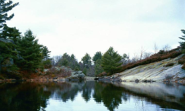 the deep bay. This is where
the McDonald River leaves the lake and tumbles over a spectacular falls into McCrae Lake.
The portage leads steep up the smooth rock on the right and drops immediately down the
other side to the sandy beach. It's a pretty spot, with a good view in both directions,
and a chance to look down where the river tumbles about 20 ft down over bare rocks. I once
took
the deep bay. This is where
the McDonald River leaves the lake and tumbles over a spectacular falls into McCrae Lake.
The portage leads steep up the smooth rock on the right and drops immediately down the
other side to the sandy beach. It's a pretty spot, with a good view in both directions,
and a chance to look down where the river tumbles about 20 ft down over bare rocks. I once
took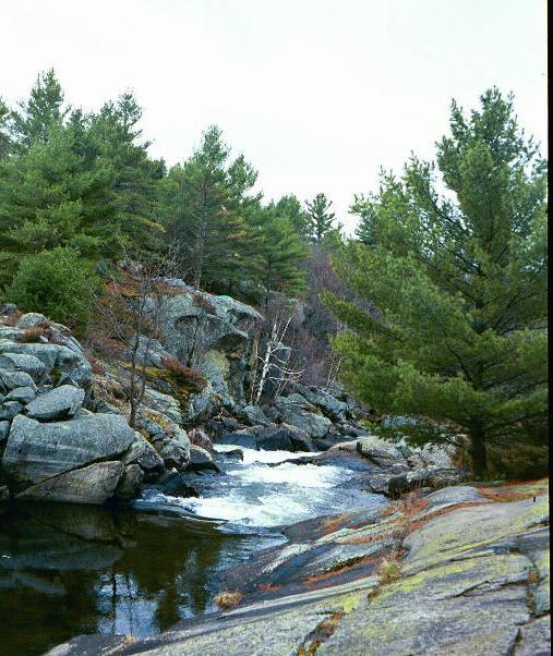 an artist for afternoon's paddle: he stopped here and found it worthwhile to capture the
beauty on canvas.
an artist for afternoon's paddle: he stopped here and found it worthwhile to capture the
beauty on canvas.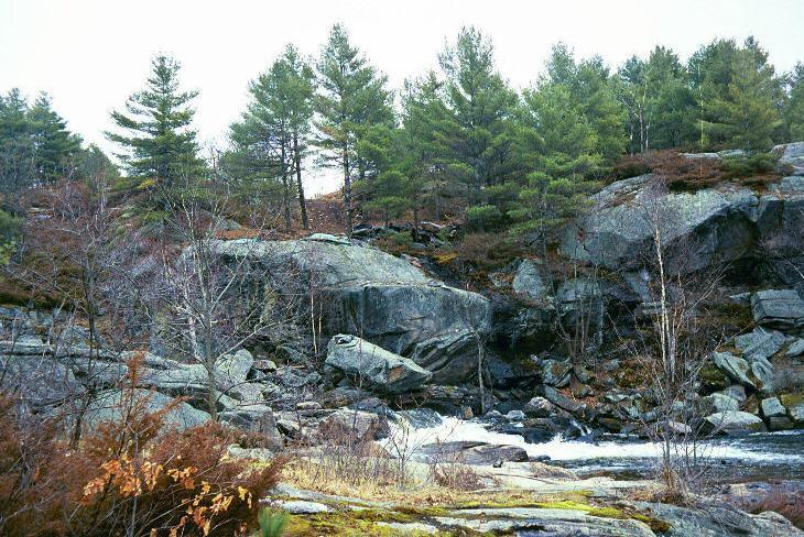 most
beautiful part? It's like putting a parking lot in the middle of the Sistine Chapel...
most
beautiful part? It's like putting a parking lot in the middle of the Sistine Chapel...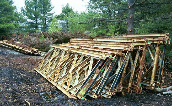
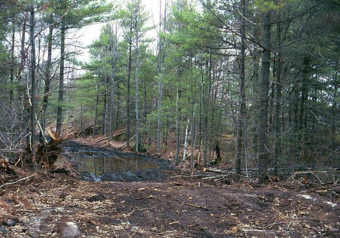 bulldozed
in both directions. The road is typically 20ft wide (the bio assessment says 12 ft, but
the bulldozer was more generous than that), with extra space in turns, and a future need
for gravel and more culverts. It may delight someone travelling on a snowmobile, but once
the snow is gone, this road is an ugly intrusion into the forest.
bulldozed
in both directions. The road is typically 20ft wide (the bio assessment says 12 ft, but
the bulldozer was more generous than that), with extra space in turns, and a future need
for gravel and more culverts. It may delight someone travelling on a snowmobile, but once
the snow is gone, this road is an ugly intrusion into the forest.